Port Ballona, California
19th century planned harbor of Santa Monica BayPort Ballona is an archaic place name for an area near the center of Santa Monica Bay in coastal Los Angeles County, where Playa Del Rey and Del Rey Lagoon are located today. Port Ballona was a planned harbor and town site from circa 1859 to 1903. The name comes from the Rancho La Ballona Mexican land grant.
Read article


Top Questions
AI generatedMore questions
Nearby Places

Marina del Rey, California
Census-designated place in the United States

Fisherman's Village
Tourist attraction in Marina del Rey, California, USA

Chace Park
Park in Marina del Rey, California, United States

Machado, California
Archaic place name
Silicon Beach
Technology hub in California, US
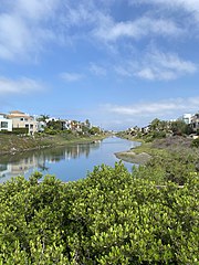
Ballona Lagoon
Tidal wetland in Southern California, US

Los Angeles County Department of Beaches and Harbors
County Department of Beaches and Harbors

Oxford Basin
Body of water in California, US